搜索结果: 1-15 共查到“工学 terrestrial”相关记录265条 . 查询时间(0.093 秒)

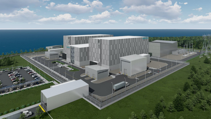
Terrestrial SMR completes Canadian pre-licensing review(图)
地面SMR 加拿大 地面能源整体熔盐反应堆
font style='font-size:12px;'>
2023/4/21
THE SUITABILITY OF TERRESTRIAL LASER SCANNING FOR BUILDING SURVEY AND MAPPING APPLICATIONS
Terrestrial Laser Scanning Handheld Mobile Laser Scanning Building Survey Mapping
font style='font-size:12px;'>
2019/3/4
The popularity of Terrestrial Laser Scanner (TLS) has been introduced into a field of surveying and has increased dramatically especially in producing the 3D model of the building. The used of terrest...
COMPARISON WITH ACCURACY OF TERRESTRIAL LASER SCANNER BY USING POINT CLOUD ALIGNED WITH SHAPE MATCHING AND BEST FITTING METHODS
laser scanning time of flight phase shift shape matching natural distributions Ostia
font style='font-size:12px;'>
2019/3/4
Recently operation systems of laser scanning have been obviously improved; for instance shape matching has been equipped with software on a post processing stage so measurement without any targets is ...
QUALITY FEATURES FOR THE INTEGRATION OF TERRESTRIAL AND UAV IMAGES
photogrammetry data fusion terrestrial images UAV
font style='font-size:12px;'>
2019/3/1
The paper presents an innovative approach for improving the orientation results when terrestrial and UAV images are jointly processed. With the existing approaches, the processing of images coming fro...
TERRESTRIAL LASER SCANNER AND FAST CHARACTERIZATION OF SUPERFICIAL LESIONS IN ARCHITECTURAL DIAGNOSIS
errestrial laser scanner pathology defensive towers masonry Camarles Tower
font style='font-size:12px;'>
2019/3/1
The development of massive data captures techniques (MDC) in recent years, such as the Terrestrial Laser Scanner (TLS), raises the possibility of developing new assessment procedures for architectural...
THE SUITABILITY OF TERRESTRIAL LASER SCANNING FOR STRATA BUILDING
Terrestrial Laser Scanning Strata building
font style='font-size:12px;'>
2018/11/8
During the recent years, the used of terrestrial laser scanning (TLS) is becoming rapidly popular because of its ability in several applications, especially the ability to observe complex documentatio...
EVALUATING THE PERFORMANCE OF TERRESTRIAL LASER SCANNING FOR LANDSLIDE MONITORING
landslide monitoring terrestrial laser scanning scanning resolutions geodetic method deviation maps
font style='font-size:12px;'>
2018/11/8
Nowadays, Terrestrial Laser Scanning (TLS) technology is gaining popularity in monitoring and predicting the movement of landslide due to the capability of high-speed data capture without requiring a ...
A SLIDING WINDOW METHOD FOR DETECTING CORNERS OF OPENINGS FROM TERRESTRIAL LIDAR DATA
Sliding Window Corners Detection Openings Detection LiDAR Point Clouds LoD3 Modelling
font style='font-size:12px;'>
2018/11/9
Architectural building models (LoD3) consist of detailed wall and roof structures including openings, such as doors and windows. Openings are usually identified through corner and edge detection, base...
ROBUST FEATURE MATCHING IN TERRESTRIAL IMAGE SEQUENCES
Feature Detection Feature Matching SIFT SURF RANSAC 3D Reconstruction
font style='font-size:12px;'>
2018/5/11
From the last decade, the feature detection, description and matching techniques are most commonly exploited in various photogrammetric and computer vision applications, which includes: 3D reconstruct...
THREE-DIMENSIONAL RECONSTRUCTION OF THE VIRTUAL PLANT BRANCHING STRUCTURE BASED ON TERRESTRIAL LIDAR TECHNOLOGIES AND L-SYSTEM
Terrestrial LiDAR L-system Branching structure Point cloud data Topology structure
font style='font-size:12px;'>
2018/5/14
For the purpose of extracting productions of some specific branching plants effectively and realizing its 3D reconstruction, Terrestrial LiDAR data was used as extraction source of production, and a 3...
AUTOMATIC MATCHING OF LARGE SCALE IMAGES AND TERRESTRIAL LIDAR BASED ON APP SYNERGY OF MOBILE PHONE
Mobile phone APP Images Laser Point Cloud Matching
font style='font-size:12px;'>
2018/5/16
The digitalization of Cultural Heritage based on ground laser scanning technology has been widely applied. High-precision scanning and high-resolution photography of cultural relics are the main metho...
3D SURVEY IN COMPLEX ARCHAEOLOGICAL ENVIRONMENTS: AN APPROACH BY TERRESTRIAL LASER SCANNING
Terrestrial Laser Scanner 3D documentation 3D Model Archaeological excavation
font style='font-size:12px;'>
2018/6/4
The survey of archaeological sites by appropriate geomatics technologies is an important research topic. In particular, the 3D survey by terrestrial laser scanning has become a common practice for 3D ...
INDIVIDUAL ROCKS SEGMENTATION IN TERRESTRIAL LASER SCANNING POINT CLOUD USING ITERATIVE DBSCAN ALGORITHM
DBSCAN rocks segmentation terrestrial laser scanning fluvial transport
font style='font-size:12px;'>
2018/6/5
The fluvial transport is an important aspect of hydrological and geomorphologic studies. The knowledge about the movement parameters of different-size fractions is essential in many applications, such...
TERRESTRIAL PHOTOGRAMMETRY VS LASER SCANNING FOR RAPID EARTHQUAKE DAMAGE ASSESSMENT
Terrestrial photogrammetry Structure from Motion Laser scanning Earthquake damage assessment Point clouds
font style='font-size:12px;'>
2018/4/18
Building damage assessment caused by earthquakes is essential during the response phase following a catastrophic event. Modern techniques include terrestrial and aerial photogrammetry based on Structu...
INTEGRATION OF TERRESTRIAL AND UAV PHOTOGRAMMETRY FOR THE ASSESSMENT OF COLLAPSE RISK IN ALPINE GLACIERS
Forni Glacier Glaciology Photogrammetry Structure-from-Motion UAV/UAS
font style='font-size:12px;'>
2018/4/18
The application of Structure-from-Motion photogrammetry with ground-based and UAV-based camera stations can be effectively exploited for modeling the topographic surface of Alpine glaciers. Multi-temp...


