搜索结果: 1-5 共查到“遥感信息工程 RS”相关记录5条 . 查询时间(0.078 秒)

河海大学地球科学与工程学院测绘系博士生杨莹莹在遥感顶级期刊ISPRS P&RS发表论文(图)
河海大学地球科学与工程学院 博士生 杨莹莹 遥感顶级期刊 常绿森林信息
font style='font-size:12px;'>
2020/4/14
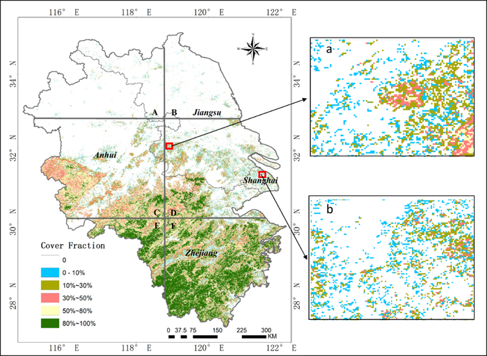
地学院测绘系18级博士生杨莹莹同学论文‘Fractional evergreen forest cover mapping by MODIS time-series FEVC-CV methods at sub-pixel scales’被一区期刊 ISPRS Journal of Photogrammetry and Remote Sensing接收发表,基于中等分辨率遥感时间序列数据实现了大尺...
THE RS IMAGES RESTORATION OF CBERS-2 BASED ON ATMOSPHERIC MTF EVALUATION USING METEOROLOGICAL DATA
Images Restoration RS images Atmospheric MTF Meteorological Data CBERS-2 satellite Turbulence and aerosols
font style='font-size:12px;'>
2015/12/28
Atmospheric MTF(Modulation Transfer Function) takes a critical role in restoration of atmospheric blurred RS(Remote Sensing) images. This MTF can be determined by meteorological data. Among the existi...
THE USING GEOINFORMATIONAL SYSTEM (GIS)AND DATA OF REMOTE SENSING (RS)TO ESTIMATION OF RISING OF LEVEL OF CASPIAN SEA
Caspian Sea Geoinformation System Database Inundated Zone Thematical Map Software
font style='font-size:12px;'>
2015/2/4
It is considered the problems of the estimation of dynamics of the change for the shore line of the Caspian Sea from
1977 to 2000 for selected sites of the territory of the Azerbaijan Republic. It is...
基于RS/GIS的嫩江县-五大连池市黑土区水土流失分析
嫩江县-五大连池市黑土区 遥感和地理信息系统 水土流失 关联因子 指标
font style='font-size:12px;'>
2010/1/4
应用RS和GIS技术,利用1988年TM数据和2002年ETM数据,引入动态度、转变强度、转变级别和黑土变化指数等指标量化黑土区水土流失的动态变化特征和时空分布规律。结果表明,嫩江县-五大连池市黑土区现有黑土为主的耕地5 700.55 km2,占全区总面积的23.55%;14年间,黑土为主的耕地减少559.38 km2,黑土流失严重,人类活动加剧了黑土减少的趋势;引入的黑土变化指数评价方法可反...

