搜索结果: 1-15 共查到“图象处理 3D”相关记录19条 . 查询时间(0.156 秒)
Parallax Photography: Creating 3D Cinematic Effects from Stills
Image-Based Rendering Photo and Image editing .
font style='font-size:12px;'>
2016/5/24
We present an approach to convert a small portion of a light field
with extracted depth information into a cinematic effect with simulated,
smooth camera motion that exhibits a sense of 3D parallax....
Large-Scale Vector Data Displaying for Interactive Manipulation in 3D Landscape Map
3D Landscape Map Large-scale Vector Data Manipulation Displaying
font style='font-size:12px;'>
2015/12/16
Displaying large-scale 3D vector data in landscape map is very important, as 3D vector data can provide many important information, such as: precise geographic boundaries, areas, 3D text marks, differ...
THE APPLICATION OF CONTENT-BASED INDEXING AND RETRIEVAL OF DIGITAL PICTURES AND RANGE IMAGES TO THE 3D VIRTUAL RECONSTRUCTION OF COMPLEX SITES AND ARCHITECTURES
Content-based indexing/retrieval model range images registration three-dimensional 3D
font style='font-size:12px;'>
2015/10/8
The modelling of complex objects and sites involve the acquisition of a large number of texture maps and range images; each one of
them representing a particular viewing angle. These views must be c...
A 3D Multi-Aperture Image Sensor Architecture
3D Multi-Aperture Image Sensor Architecture
font style='font-size:12px;'>
2015/8/17
An image sensor comprising an array of apertures each with its own local integrated optics and pixel array is presented. A lens focuses the image above the sensor creating overlapping elds of view bet...
INTEGRATED USE OF TM IMAGE, DTM AND 3D VISUALIZATION IN GROUNDWATER STUDIES ON KARSTIFIED MARBLES
Geology Resources Integration Interpretation
font style='font-size:12px;'>
2015/7/29
The purpose of this study was the evaluation of integrated use of landsat TM imagery, Digital Terrain Model (DTM) and 3D
visualization for groundwater studies on karstified marbles. It was used a mu...

最大规模银河系星际尘埃3D图出炉(图)
银河系星 3D图
font style='font-size:12px;'>
2015/7/16
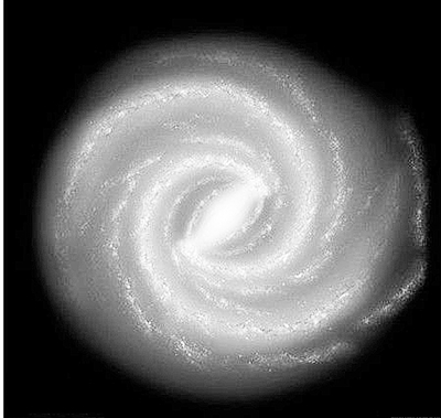
太空尘埃其实很美丽,美国哈佛大学研究人员最新绘制的银河系尘埃3D图像显示,整个银河系星星点点地散落着星际尘埃。这是同类图像中规模最大的一幅,覆盖了四分之三的天空,从某种意义上来说,它也算得上是银河系的“自拍照”。借助尘埃的分布,科学家将能更好地勾画银河系的模样。
EXTRACTING 3D FREE-FORM SURFACE BOUNDARIES OF MAN-MADE OBJECTS FROM MULTIPLE CALIBRATED IMAGES: A ROBUST, ACCURATE AND HIGH RESOLVING POWER EDGEL MATCHING AND CHAINING APPROACH
Photogrammetry 3D Reconstruction
font style='font-size:12px;'>
2015/5/18
This paper describes a purely geometrical approach for matching and chaining edgels, i.e. contours points with their tangent direction,
to reconstruct in a general way 3D rectilinear or curved surfac...

First-Ever 3D Image Created of the Structure Beneath Sierra Negra Volcano in the Galapagos(图)
Beneath Sierra Negra 3D Galapagos
font style='font-size:12px;'>
2014/3/20
The Galápagos Islands are home to some of the most active volcanoes in the world, with more than 50 eruptions in the last 200 years. Yet until recently, scientists knew far more about the history of f...
2D视频转3D视频是解决3D片源不足的主要手段,而单幅图像的深度估计是其中的关键步骤.提出基于加权SIFT流深度迁移和能量模型优化的单幅图像深度提取方法.首先利用图像的全局描述符从深度图数据库中检索出近邻图像;其次通过SIFT流建立输入图像和近邻图像之间像素级稠密对应关系;再次由SIFT流误差计算迁移权重,将近邻图像对应像素点的深度乘以权重后迁移到输入图像上;然后利用均值滤波对迁移后的近邻图像深度...
ACCURATE 3D TEXTURED MODELS OF VESSELS FOR THE IMPROVEMENT OF THE EDUCATIONAL TOOLS OF A MUSEUM
3D textured model Museums Structured light scanner Complex surfaces Visualization
font style='font-size:12px;'>
2014/4/25
Besides the demonstration of the findings, modern museums organize educational programs which aim to experience and knowledge
sharing combined with entertainment rather than to pure learning. Toward...
A NOVEL METHOD FOR AUTOMATION OF 3D HYDRO BREAK LINE GENERATION FROM LIDAR DATA USING MATLAB
LiDAR Water body Classification Break lines Histogram
font style='font-size:12px;'>
2014/4/21
Water body detection is necessary to generate hydro break lines, which are in turn useful in creating deliverables such as TINs,
contours, DEMs from LiDAR data. Hydro flattening follows the detect...
ASSESSING FAÇADE VISIBILITY IN 3D CITY MODELS FOR CITY MARKETING
Visibility analysis human visual perception workflow analysis requirements analysis
font style='font-size:12px;'>
2014/4/21
In city marketing, different applications require the evaluation of the visual impression of displays in the urban environment on
people that visit the city. Therefore, this research focuses on the...
基于动态扫描理论的3D空间轮廓查询算法
轮廓 支配 渐进处理
font style='font-size:12px;'>
2009/8/12
轮廓操作和轮廓计算在数据库通信、决策支持、数据可视化以及空间数据库等应用中具有重要作用。该文分析现有方法,指出其在渐进处理、查询高效性和用户后期筛选方便性等方面存在的问题,提出基于轮廓点支配定理、应用空间几何原理的3D动态割面轮廓查询算法。通过实例分析和实验证明其可行性、高效性和准确性。

