搜索结果: 1-15 共查到“知识库 天体测量学”相关记录294条 . 查询时间(1.762 秒)
外行星暗弱卫星的高精度天体测量与运动学研究
外行星 暗弱卫星 高精度 天体测量
font style='font-size:12px;'>
2023/8/21

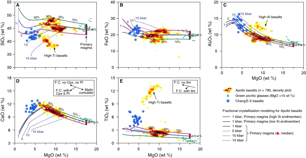
苏斌等-SA:嫦娥五号玄武岩揭秘月球年轻火山成因之谜(图)
嫦娥五号 玄武岩 月球年轻火山
font style='font-size:12px;'>
2023/1/16

王俊逸等-RS等:爆炸式增长的空间目标对SYISR电离层观测的影响及应对(图)
爆炸式增长 空间目标 SYISR电离层
font style='font-size:12px;'>
2023/1/16

NG:基于重力数据获取的月壳孔隙度记录月表撞击成坑历史(图)
重力数据获取 月壳孔隙度 月表撞击成坑历史
font style='font-size:12px;'>
2023/1/14

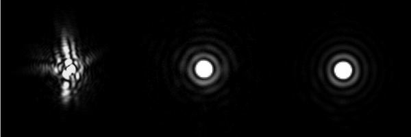
研究提出基于焦面复制方法的超级自适应光学系统非共光路波像差及静态波像差校正技术(图)
焦面复制 自适应光学系统 非共光路波像差 静态波像差
font style='font-size:12px;'>
2022/9/14

南山26米射电望远镜助力探究大熊座“闪电”FRB精确位置(图)
大熊座“闪电” FRB精确位置 射电望远镜
font style='font-size:12px;'>
2023/1/13

INVESTIGATING THE STATE OF PLAY OF GEOBIM ACROSS EUROPE
BIM GIS Interoperability GeoBIM Research Challenges interoperability data integration National Mapping and Cadastral Agency
font style='font-size:12px;'>
2018/11/9
In both the Geographic Information (Geo) and Building Information Modelling (BIM) domains, it is widely acknowledged that the integration of data from both domains is beneficial and a crucial step in ...
BASELINE ERROR ANALYSIS AND EXPERIMENTAL VALIDATION FOR HEIGHT MEASUREMENT OF FORMATION INSAR SATELLITE
InSAR Height Measurement Baseline Error DEM Simulation Validation SRTM TerraSAR-X/TanDEM-X
font style='font-size:12px;'>
2018/5/14
In this paper, we proposed the stochastic model of InSAR height measurement by considering the interferometric geometry of InSAR height measurement. The model directly described the relationship betwe...
大西安正在进行国际化大都市的建设,建设过程中的政府决策、防灾减灾、规划设计、施工与运营管理等环节都面临着许多与岩土体和地质环境相关的重大问题,尤其是滑坡治理与预报工作。本文通过大量野外调查、测绘和勘查,统计分析了大西安地区发育的滑坡,将大西安地区的滑坡按滑体特征、动力成因和滑动特征分为三大类,又进一步按诱发因素、物质组成、滑面埋深、滑体规模和力学性质进行相应的分类,并从滑坡形貌、滑带与纵断面、变形...
受地球非球形引力、第三体摄动和太阳光压等摄动因素的影响,导航卫星位置存在长周期变化趋势,需要定期对导航卫星进行轨道机动,以保持卫星轨位和导航服务区.导航卫星机动后的定轨,特别是GEO卫星,其频繁轨控后的轨道快速确定问题,是制约卫星可用度和导航系统服务性能的重要因素.在基于伪距相位数据的轨道测定中,轨道与钟差的统计相关是制约卫星轨道快速确定的关键因素,特别是在观测弧段短的情况下,待估参数之间的相关性...
SEAR(Surfactant-enhanced aquifer remediation)技术被用于修复DANPL,其修复机制分为增溶作用和驱替作用,其中驱替作用对于DNAPL的修复更为有效.多孔介质中DNAPL的驱替运移过程中,定量评价DNAPL的修复行为极为重要.本文利用多相流数值模型UTCHEM探究了流速对DNAPL驱替运移行为的影响.通过截留数定量评价流速变化时DNAPL的驱替行为,结果表...
One year of tropospheri clidar measurements of aerosol extinction and backscatter
lidar EARLINET aerosol
font style='font-size:12px;'>
2015/9/16
The aerosol lidar system operational at IMAA-CNR in Tito Scalo (PZ) (Southern Italy, 40°36'N, 15°44'E, 820 m
above sea level) is part of the EARLINET project. Systematic lidar measurements of aerosol...
MEASURING COMPLETE GROUND-TRUTH DATA AND ERROR ESTIMATES FOR REAL VIDEO SEQUENCES, FOR PERFORMANCE EVALUATION OF TRACKING, CAMERA POSE AND MOTION ESTIMATION ALGORITHMS
Vision robotics tracking navigation registration
font style='font-size:12px;'>
2015/8/14
Fundamental tasks in computer vision include determining the position, orientation and trajectory of a moving camera relative to an
observed object or scene. Many such visual tracking algorithms hav...
THE CEOS RECOVERY OBSERVATORY PILOT
Earth Observation post-disaster recovery
font style='font-size:12px;'>
2015/5/7
Over the course of the last decade, large populations living in vulnerable areas have led to record damages and substantial loss of life in mega-disasters ranging from the deadly Indian Ocean tsunam...


