搜索结果: 1-15 共查到“知识库 海洋调查与监测”相关记录466条 . 查询时间(2.265 秒)
日本核污染水排海给经济复苏添堵
日本 核污染水 海洋环境 经济复苏
font style='font-size:12px;'>
2023/8/7

AAS: 2022年,海洋热含量、盐度、层化等多个环境参数变化再创新高(图)
海洋 热含量 盐度 层化 再创新高
font style='font-size:12px;'>
2023/2/13

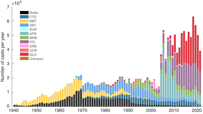
DSR: 新一代海洋数据质控系统揭示出更高的海洋变暖速率(图)
海洋数据 质控系统 海洋变暖速率
font style='font-size:12px;'>
2023/2/13

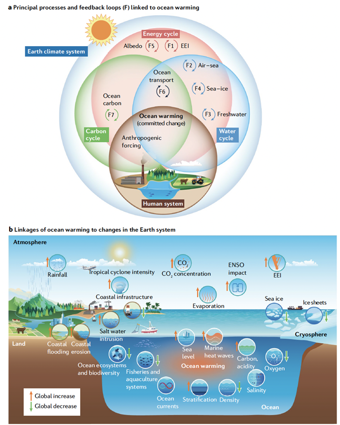
NREE: 综述过去和未来的海洋变暖特征、机制和影响(图)
海洋变暖 海洋热含量变化 全球气候变化
font style='font-size:12px;'>
2023/2/13
REPEATABLE DEPLOYMENT OF AN OPEN STANDARDS, OPEN SOURCE AND OPEN DATA STACK FOR BUILDING A FEDERATED MARINE DATA MANAGEMENT AND DECISION SUPPORT SYSTEM FOR SOUTH AFRICA
Open standards Interoperability Data Management System CKAN CSW Case Study Distributed Systems Architecture Oceans and Coasts DevOps
font style='font-size:12px;'>
2018/11/8
The National Oceans and Coastal Information Management System (OCIMS) of South Africa is a large, integrated IT system for enhancing oceans, coastal and maritime governance, and supporting sustainable...
REFINE OF REGIONAL OCEAN TIDE MODEL USING GPS DATA
GPS Ocean Tide Model Time Series Spectral Inversion PPP
font style='font-size:12px;'>
2018/5/15
Due to lack of regional data constraints, all global ocean tide models are not accuracy enough in offshore areas around China, also the displacements predicted by different models are not consistency....
AUTOMATED MOSAICKING OF GEOSTATIONARY OCEAN COLOR IMAGER BY COMBINATION OF SPATIAL AND FREQUENCY MATCHING
GOCI Ocean Image Mosaicking Geometric Correction Frequency Matching
font style='font-size:12px;'>
2018/6/4
In general, image mosaicking is a useful and important processing for handling images with narrow field of view. It is being used widely for images from commercial cameras as well as from aerial and s...
MONITORING EROSION AND ACCRETION SITUATION IN THE COASTAL ZONE AT KIEN GIANG PROVINCE
erosion/accretion Kien Giang province Normalized Difference Water Index (NDWI) shoreline
font style='font-size:12px;'>
2018/4/18
Kien Giang is one of the coastal provinces in the Mekong Delta which is facing the problem of coastal erosion to affect people’s life in the coastal area. This project aims to monitor shoreline and to...
POSSIBILITIES OF THE JOINT USE OF OPTICAL AND RADAR DATA IN FLOOD SPACE MONITORING
Remote Sensing Space Monitoring High Waters Flood Radar Data Radar Polarimetry
font style='font-size:12px;'>
2018/4/18
The article gives a brief description of the system of space monitoring of high water and floods. Its main tasks are the operational dynamics of snow and ice cover melting and the passage of flood wat...
RECENT SEA LEVEL CHANGES IN THE BLACK SEA FROM SATELLITE GRAVITY AND ALTIMETER MESUREMENTS
Black Sea Sea Level Change Altimetry GRACE
font style='font-size:12px;'>
2018/5/8
Sea level rise causes devastating effects on coastal habitats. For example, coastal erosion and saltwater intrusion are major threats for the Black Sea coasts. So, determining sea level changes in the...
Ultraviolet radiation and aerosol monitoring at Lampedusa, Italy
UV radiation aerosol ozone radiative transfer radiative forcing
font style='font-size:12px;'>
2015/9/16
The measurements of UV spectral irradiance, ozone and aerosol load obtained with a double monochromator Brewer
at the Station for Climate Observations of the National Agency for New Technology, Energ...
The Application of Video Image Processing to the Study of Nearshore Processes
Nearshore Processes Video Image
font style='font-size:12px;'>
2015/8/19
Perhaps the most popular oceanographic setting for the public is the beach and nearshore environment. Poetic accounts since early history describe the comings and goings of tides, waves and sand. More...
Autonomous Oceanographic Sampling Networksv
Sampling Networksv Ocean
font style='font-size:12px;'>
2015/8/19
Spatially adaptive sampling is necessary to resolve evolving gradients with sparsely distributed sensors. Assessing the reality of numerical model fields with ever increasing resolution, testing dynam...
Monitoring Ocean Earthquakes With SOSUS:An Example From the Caribbean
Monitoring Ocean Earthquakes SOSUS the Caribbean
font style='font-size:12px;'>
2015/8/14
T-phases are acoustic signals in which the primary portion of the propagation path is through tile oceans. Energy sources resulting m the generation of T-phases include earthquakes, submarine volcanis...
Exploration of the Straits of Florida and Great Bahama Bank
Florida Great Bahama Bank
font style='font-size:12px;'>
2015/8/10
The Straits of Florida is a trough that separates the Florida
Peninsula from Cuba and the Great Bahama Bank (Figure 1).
It acts as both a conduit and a barrier for ecosystem exchange
and is an i...


