搜索结果: 1-15 共查到“理学 K-P-Means”相关记录135条 . 查询时间(0.078 秒)
Academy of Mathematics and Systems Science, CAS Colloquia & Seminars:Large deviations principle for weighted means of a recursive numerical method for ergodic SDEs
遍历 SDE递归 数值方法 加权均值 大偏差原理
font style='font-size:12px;'>
2023/4/24
The movement of small water droplets is controlled by means of a magnet
magnet water movement magnetic field
font style='font-size:12px;'>
2021/8/11
A new study has presented and characterized the formation and properties of a superparamagnetic ring, which fits snugly around a drop of water due to liquid-liquid interaction, and allows the drops to...
基于逻辑回归函数的加权K-means聚类算法
欧式距离 特征加权的K-means算法 逻辑回归函数 初始聚类中心
font style='font-size:12px;'>
2022/3/15

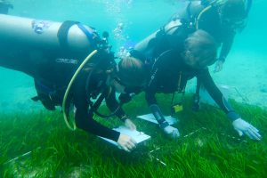
For Seagrass,Biodiversity Is Both a Goal and A Means For Restoration(图)
Seagrass Biodiversity Both a Goal Means For Restoration
font style='font-size:12px;'>
2017/11/24
Coral reefs, seagrass meadows and mangrove forests work together to make the Coral Triangle of Indonesia a hotspot for marine biodiversity. The system supports valuable fisheries and endangered specie...
MULTI-PATCHES IRIS BASED PERSON AUTHENTICATION SYSTEM USING PARTICLE SWARM OPTIMIZATION AND FUZZY C-MEANS CLUSTERING
Particle swarm optimization Fuzzy c-means Taylor’s series expansion weighted mean Hamming distance Iris recognition system
font style='font-size:12px;'>
2017/6/19
Locating the boundary parameters of pupil and iris and segmenting the noise free iris portion are the most challenging phases of an automated iris recognition system. In this paper, we have presented ...
3D BUILDING MODELS SEGMENTATION BASED ON K-MEANS++ CLUSTER ANALYSIS
3D model segmentation cluster segmentation 3D building model K-means++ cluster
font style='font-size:12px;'>
2016/10/14
3D mesh model segmentation is drawing increasing attentions from digital geometry processing field in recent years. The original 3D mesh model need to be divided into separate meaningful parts or surf...
Researchers Create Means to Monitor Anthropogenic Global Warming in Real Time
Researchers Monitor Anthropogenic Global Warming Real Time
font style='font-size:12px;'>
2016/8/1
A research team including a Scripps Institution of Oceanography at the University of California San Diego climate scientist simulated in a computer model, for the first time, the realistic evolution o...
Tests atternative to higher criticism for high dimensional means under sparsity and column-wise dependence
Large deviation Large p, small n Optimal detection boundary Sparse signal Thresholding Weak dependence
font style='font-size:12px;'>
2016/1/25
We consider two alternative tests to the Higher Criticism test of Donoho and Jin (2004) for high dimensional means under the spar-sity of the non-zero means for sub-Gaussian distributed data with unkn...
Aerosol optical thickness of Mt. Etna volcanic plume retrieved by means of the Airborne Multispectral Imaging Spectrometer (MIVIS)
aerosol optical thickness volcanic plume MIVIS DEM radiative transfer model 6S inversion technique
font style='font-size:12px;'>
2015/9/16
Within the framework of the European MVRRS project (Mitigation of Volcanic Risk by Remote Sensing
Techniques), in June 1997 an airborne campaign was organised on Mt. Etna to study different character...
Ionospheric Doppler measurements by means of HF-radar techniques
shift Doppler ionosphere plasma drift
font style='font-size:12px;'>
2015/9/10
Studies of the dynamics of the ionosphere and its related phenomena are mainly based on Doppler Drift measurements. The time variation (ionisation/recombination) of plasma density, thermospheric wind ...
Validation of a method for ionospheric electron density reconstruction by means of vertical incidence data during quiet and storm periods
electron density model vertical incidence ionograms ionospheric data ingestion
font style='font-size:12px;'>
2015/9/10
A preliminary validation of the technique developed using the NeQuick ionospheric model and the 玡ffective ionization
parameter?Az, based on vertical total electron content data ingestion, was carried...
Perspectives of 2D and 3D mapping of atmospheric pollutants over urban areas by means of airborne DOAS spectrometers
DOAS applications in urban areas atmospheric pollutants tomography aircraft measurements of atmospheric trace gases
font style='font-size:12px;'>
2015/9/7
In the field of air quality control, optical remote sensing systems can measure the spatial distribution of gas pollutants, offering numerous advantages over conventional networks of in situ analysers...
Memories of the past contribute to prevention: photography as a direct means for public understanding of science
Memories Prevention Historical images
font style='font-size:12px;'>
2015/8/26
There are thousands of ways to achieve a sustainable future for our Planet. Some of these follow high-value scientific research activities, while others simply aim to increase people’s awareness of wh...
Focus maps:a means of prioritizing data collection for efficient geo-risk assessment
Geo-risk assessment Vulnerability Data collection Sampling
font style='font-size:12px;'>
2015/8/17
Efficient Disaster Risk Reduction (DRR) management constantly calls upon high-quality information to be collected or updated for vulnerability monitoring and risk assessment. This process is often res...
Focus maps: a means of prioritizing data collection for efficient geo-risk assessment
Geo-risk assessment Vulnerability Data collection Sampling
font style='font-size:12px;'>
2015/8/14
Efficient Disaster Risk Reduction (DRR) management constantly calls upon high-quality information to be collected or updated for vulnerability monitoring and risk assessment. This process is often res...


