
�������: 1-15 ���鵽������ѧ Area����ؼ�¼29�� . ��ѯʱ��(0.281 ��)
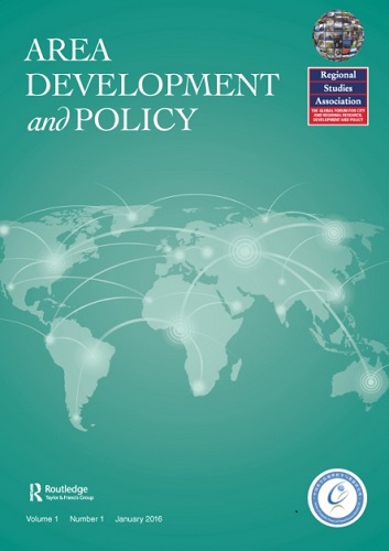
�й���ѧԺ������ѧ����Դ�о�������������о�Э�����ϴ����ѧ���ڿ�Area Development and Policy��Scopus��¼
�й���ѧԺ������ѧ����Դ�о��� ���������о�Э�� ѧ���ڿ� Area Development and Policy Scopus ��¼
font style='font-size:12px;'>
2018/7/25
2018��7��12��,���й���ѧԺ������ѧ����Դ�о�������������о�Э�����ϴ��졢Taylor & Francis���淢�е�ѧ���ڿ�Area Development and Policy��ʽ��Scopus��¼�����Ǽ̱�ESCI��¼֮��Area Development and Policy�ٴα����綥���ڿ������������ݿ���¼��Scopus ������ѡίԱ��߶�������Area Development ...
�й���ѧԺ������ѧ����Դ�о�������������о�Э�����ϴ����ѧ���ڿ�Area Development and Policy��ESCI��¼
�й���ѧԺ������ѧ����Դ�о��� ���������о�Э�����ϴ����ѧ���ڿ� Area Development and Policy ESCI
font style='font-size:12px;'>
2018/6/22
����Taylor & Francis�������֪ͨ�����й���ѧԺ������ѧ����Դ�о�������������о�Э�ᣨRegional Studies Association, RSA�����ϴ��졢Taylor & Francis���淢�е�ѧ���ڿ�Area Development and Policy��ʽ��ESCI (Emerging Sources Citation Index) ��¼��
GLACIER FRONTAL LINE EXTRACTION FROM SENTINEL-1 SAR IMAGERY IN PRYDZ AREA
SAR Glacier Frontal Sentinel-1 CFAR Profile analysis
font style='font-size:12px;'>
2018/5/14
Synthetic Aperture Radar (SAR) can provide all-day and all-night observation of the earth in all-weather conditions with high resolution, and it is widely used in polar research including sea ice, sea...
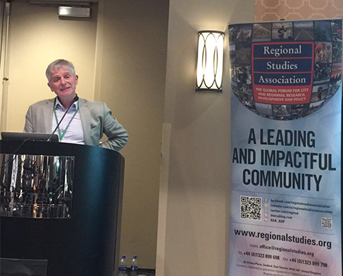
��Area Development and Policy���ٰ����ѧ���������ϻ�2018�����ȱ���ֻ᳡��ͼ��
Area Development and Policy ����ѧ�� �������ϻ� 2018��
font style='font-size:12px;'>
2018/4/20
2018��4��10-14�գ�����ѧ���������ϻᣨAAG��2018���������·��˹�������°¶����о��С�����ʱ��4��13�����磬���й���ѧԺ������ѧ����Դ�о�������������о�Э�ᣨRegional Studies Association, RSA�����ϴ��졢Taylor & Francis��������淢�е�ѧ���ڿ�Area Development and Policy��ADP��������չ�����ߡ����ڴ˴�...
�й���ѧԺ������ѧ����Դ�о�������������о�Э��ϰ����ڿ�-- Area Development and Policy ��1�����ߣ�ͼ��
�й���ѧԺ������ѧ����Դ�о��� ���������о�Э�� Area Development and Policy
font style='font-size:12px;'>
2016/5/9
���й���ѧԺ������ѧ����Դ�о�������������о�Э�ᣨRegional Studies Association, RSA�����ϴ��졢Taylor & Francis ��������淢�е�ѧ���ڿ�Area Development and Policy ����������չ�����ߡ�����һ����������2016��4��29�����ߡ��ڿ���ַ��http://www.tandfonline.com/toc/rard20...

ѧ���ڿ���Area Development and Policy�������������������ɽ�ɽ���У�ͼ��
ѧ���ڿ�Area Development and Policy ���������� �����ɽ�ɽ
font style='font-size:12px;'>
2016/4/7
��������ʱ��2016��3��30�����磬�������о�Э�ᣨRegional Studies Association, RSA�����й���ѧԺ������ѧ����Դ�о������ϴ��졢Taylor & Francis��������淢�е�ѧ���ڿ���Area Development and Policy��ADP��������2016����������ѧ������Ͼ����˴��������ᡣ�������ھɽ�ɽ���Ϲ㳡ϣ���پƵ�Imperial B����������...
MULTILEVEL OBJECT BASED IMAGE CLASSIFICATION OVER URBAN AREA BASED HIERARCHICAL IMAGE SEGMENTATION AND INVARIANT MOMENTS
hierarchical segmentation shape object-based classification invariant moments
font style='font-size:12px;'>
2015/11/16
With the availability of very high resolution multispectral imagery from sensors such as IKONOS and Quickbird, it is possible to
identify small-scale features in urban environment. Because of the mu...
Digital image processing and geospatial analysis of landsat 7 ETM+ for mineral exploration, Abidiya area, North Sudan
Landsat 7 Spectral enhancement image transformation FPCS alteration zone
font style='font-size:12px;'>
2014/11/25
Digital data of Landsat Enhanced Thematic Mapper Plus (ETM+
7) was used in mineral
exploration investigations for the area around Abidiya area, North Sudan. The studied area
consists of Precambri...
Hydrogeochemistry of subsurface and surface water from bank of Jayanti stream, Kolhapur area, Maharashtra (India)
Groundwater geochemistry irrigation hazards graphical representation
font style='font-size:12px;'>
2014/11/19
Jayanti stream chosen for hydrogeochemical analysis which is tributary of Panchganga River
and Panchganga is a major tributary of Krishna River in part of Maharashtra state, India. In
order to ass...
Studies on heavy metals in industrial effluent, river and groundwater of Savar industrial area, Bangladesh by Principal Component Analysis
Industrial effluent Wastewater Heavy metals Principal component analysis Statistical analysis
font style='font-size:12px;'>
2014/11/12
A total number of twenty water samples of which seven groundwater, six river water and seven effluent samples were collected from Savar industrial area in Bangladesh for heavy metals analysis using IC...
Changing land use and land cover in fringe area using GIS: A case study of Barddhaman town, West Bengal
Land Resource land use land cover urban sprawl Rural-Urban fringe
font style='font-size:12px;'>
2014/11/11
Land resource is the most important natural wealth of any region and their proper utilization
is a matter of utmost concern to its people (Codjoe, 2007), Changing pattern of land use not a
static ...
Experimental Study on the Mechanics Character of Lava in the Area of Xujiaweizi
Rock mechanics Lithology Lava Experimental study
font style='font-size:12px;'>
2009/12/3
The Xujiaweizi rift in the north of Songliao Basin is the largest volcanic gas reservoir in China, and because themechanics character of lava largely influences the production and development of the o...
Remote Sensing Image Based Analysis on Present Land Utilization of Chongqing Area
City Chongqing Remote sensing interpretation Present land utilization
font style='font-size:12px;'>
2009/12/3
Based on the remote sensing images taken by China-Brazil earth resource satellite during July 2006, the paperdescribes eight types of land utilization of 1,612 km2 city Chongqing area. As a result, th...
���۷�����AREA�ϵ�SSCI����
font style='font-size:12px;'>
2007/12/26
Hui Liu(����), Changing regional rural inequality in China 1980�C2002, Area, 2006, 38.4, 377�C389.
The influences of the tectonic subsidence and the siltation on the situation of preventing flood disasters in the Dongting Lake area
font style='font-size:12px;'>
2007/8/24
With the long-term data of the geodetic sea level measurements undertaken in the Dongting Basin and the recent sediment data of Dongting Lake, we analyze the tectonic subsidence rate of th...
�й��о����������а�-��
- ���ڼ���...
�й�ѧ���ڿ����а�-��
- ���ڼ���...
�����ѧ���л������а�-��
- ���ڼ���...
�й���ѧ���а�-��
- ���ڼ���...
�ˡ���-ƪ
- ���ڼ���...
�Ρ���-ƪ
- ���ڼ���...
��������-ƪ
- ���ڼ���...
�������� -ƪ
- ���ڼ���...
֪ʶҪ��-ƪ
- ���ڼ���...
���ʶ�̬-ƪ
- ���ڼ���...
��������-ƪ
- ���ڼ���...
ѧ��ָ��-ƪ
- ���ڼ���...
ѧ��վ��-ƪ
- ���ڼ���...